Owners and operators of CESSNA aircraft around the world are embarking on a vast range of adventures every day. They’re seeing mountains, oceans, plains, rainforests and more from what many say is the best view imaginable.
This account is from Dan Holmes, a pilot and employee of Textron Aviation.
Mountain Flying Lessons in Colorado
Written by Dan Holmes
First of all, if there is anyone out there that is on the fence about taking the mountain flying course…stop thinking about it and just do it! It was one of the most thrilling, rewarding and exciting times I have had flying in a long time.
We departed Beech Field (BEC) on Friday September 25th at about 4:45pm in the CESSNA SKYLANE piston (T182T), with our final destination of the day being (APA) Centennial Airport, Colorado.
We stayed at the Ramada Hotel that was almost across the street from the TAC Air FBO (Fixed Base Operator) and ate dinner at Perfect Landings, Centennial’s airport restaurant. During dinner and after dinner we planned and mapped out our routes for the following morning.
Early Saturday morning greeted us with a cool, crisp day with light winds in the mountains. We checked the weather, filed our VFR (Visual Flight Rules) flight plans, completed the preflight inspection and we were off to the mountains. John, a fellow student, took the first leg into the mountains as PIC (Pilot in Command).
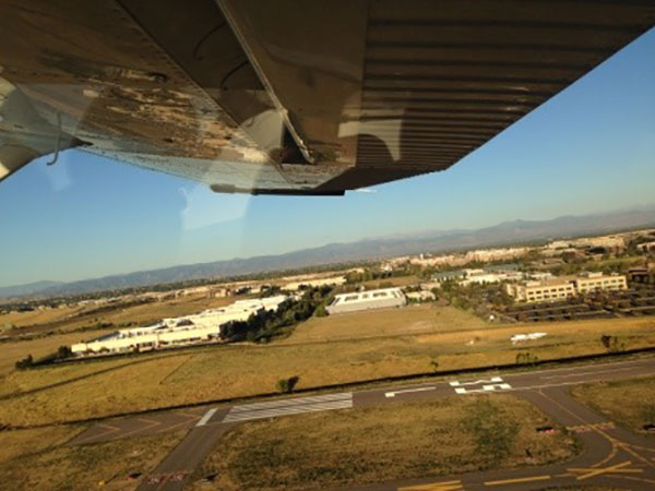
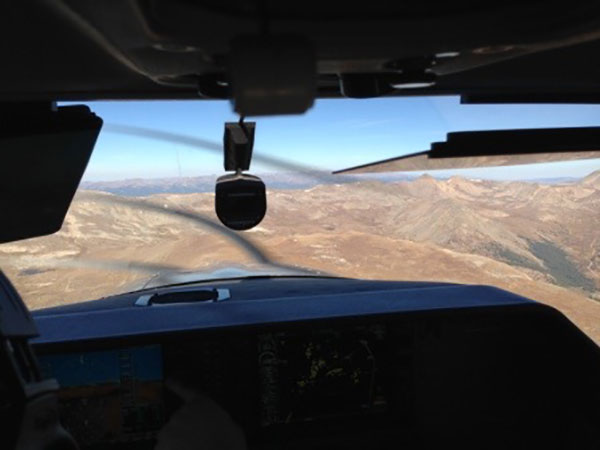
Departure out of APA (Centennial, Colorado)
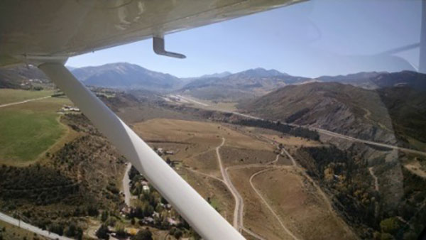
Since we were in the turbo Skylane piston, our instructor, Ed, had us simulate flying the normally aspirated Skylane piston by limiting our manifold pressure for the trip. John performed a short field take off which made us both realize the effects of density altitude and climb performance in higher altitudes. After the seemingly slow ascent, he turned west towards the mountains tracking I-70. Flying through the Front Range, John used the light winds to help gain altitude and went through Berthoud pass, over Winter Park and into the valley where Granby, Grand and Shadow Mountain Lakes greeted us.
Berthoud Pass – view looking east over the continental divide
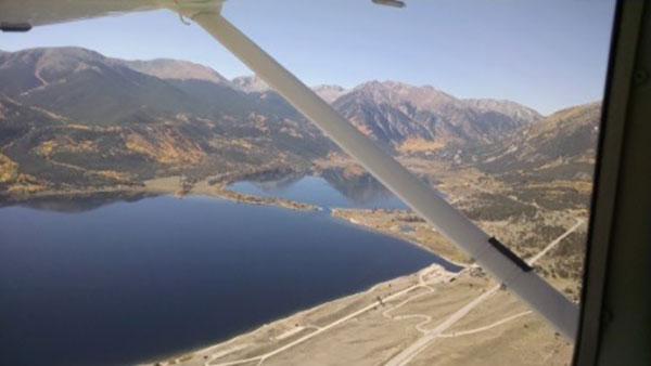
Granby Lake, Granby Colorado
He flew over Granby Lake to set up a left downwind into Granby-Grand County Airport (GNB) landing runway 9. Once on the ground we taxied down to runway 27 for a departure to the west due to the light and variable winds and it was recommended in the Colorado Airport Directory due to rising terrain to the east.
Granby-Grand County Airport (GNB) Granby, Colorado
As we were getting close to the McElroy Airfield Airport (20V) in Kremmling we heard a jet coming into the pattern for right traffic landing runway 27. John completed a 360° turn for spacing and let the jet through.
Colorado River at the approach end of runway 27 McElroy Airfield (20V) Kremmling, Colorado
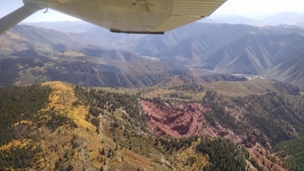
View looking east above Green Mountain Reservoir
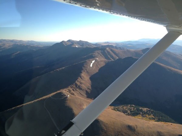
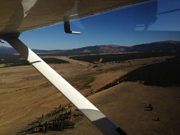
After the landing and takeoff, John pointed the turbo Skylane aircraft to the south where we flew over Green Mountain Reservoir, Dillon Reservoir and Breckenridge. With his dead reckoning and pilot age skills, John was able to identify Mosquito Pass with a 13,781-foot peak to the north of us and a 14,036 foot peak to the south of us.
Mosquito Pass, Colorado
Lake County Airport, Leadville, Colorado
Up and over the pass he guided us into the town of Leadville and home of the Lake County Airport (LXV) which is the highest elevation airport in the continental United States standing at 9,934 feet MSL (Mean Sea Level). John listened to the ASOS (Automated Surface Observing Systems) and found out the winds were light and variable. He set up for left traffic for runway 34 and made all of the standard traffic advisories. While on short final there was another radio call that came over the frequency stating that they were on the runway taking off on runway 16 coming towards us. An immediate full throttle go around was initiated by Ed after hearing this call. As we flew over the hangars, I noticed that there was a small fly-in event. Prior to the aircraft calling its departure on runway 16 we had not heard any traffic on the radio. John flew over the Turquoise Lake, northwest of the airport and set us up for right traffic for runway 16. As we were making our way back towards our second landing attempt, we all discussed the importance of proper radio calls into an uncontrolled airport and the dangers of a light to no wind day. John landed and taxied to the self-serve fuel pumps where we stretched our legs, fueled the airplane and swapped seats.
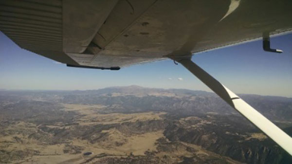
We completed the run up, leaned for peak RPM (Revolutions per Minute), checked for traffic and I lined up on the centerline of runway 16. It was about 10:30am, temperature at 20° C with a density altitude of about 11,000 feet. We limited our manifold pressure for the takeoff and I released the brakes. The 1,000 foot makers passed by us and our airspeed was just over 40 knots. It took a long time with our reduced throttle position to gain enough speed to rotate. Once we hit 55 knots with a tail low attitude, the plane came off the ground and I tried to keep in ground effect for a while to gain additional airspeed. By the time we were at the end of the 6,400-foot runway we were approximately 200 feet AGL (Above Ground Level). Respect density altitude and the preplanning performance numbers. At climb rates around 200 fpm (feet per minute) you need to plan your route carefully and use any mountain updrafts to your full advantage in order to get over to the other side of the mountain. We flew southwest towards the canyon where we planned to go through Independence Pass (12,093
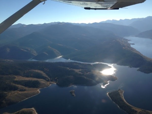
feet) to Aspen (ASE). Once at the mouth of the canyon it was very clear to me that we were not going to make it up and over the pass at our current altitude and climb rates. I completed two wide 360° turns over Twin Lakes Reservoir gaining altitude with every updraft I could find.
Twin Lakes Reservoir looking into Independence Pass
Independence Pass
At the conclusion of the second turn I pointed the plane towards the south side of the canyon where we could take advantage of the mountain updrafts due to the northerly wind. Upon feeling the updrafts I would pull the yoke back to Vx (best angle of climb) and try and gain as much altitude as possible. We were able to hit climb rates above 1500 fpm during the short duration updrafts.
I now have a better understanding of why we practice coordinated slow flight and steep turns because you use those skills in the mountains.
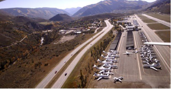
Aspen (ASE) Aspen, Colorado
Once up and over the pass I was able to get the Aspen ATIS (Automatic Terminal Information System) which stated they were landing runway 15 and departing 33 due to the rising terrain to the south and calm winds. We extended our base to allow a BEECHCRAFT KING AIR turboprop departure and the tower turned us towards runway 15. On the ground in Aspen we taxied on Alpha past more business jets than I’d ever seen in one place at one time.
Departing Aspen (ASE)
After our run up and engine leaning we were told to hold short of runway 33 for landing traffic. As we waited, #1 for departure, a large jet taxied behind us. The controller called our tail number and asked if we would let the jet behind us takeoff first. We taxied onto the active runway and over to the adjacent taxi way for a front seat view of the jet’s departure. The tower called for us to line up and wait on runway 33 with directions to turn right to 360°on the climb out. We completed a normal take off and a north heading to let the other jets taking depart with a straight shot out of the area.
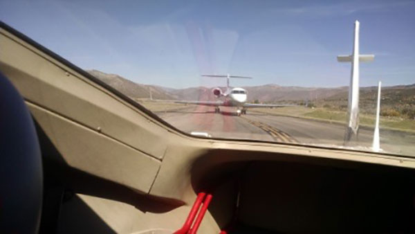
Jet behind us at Aspen (ASE)
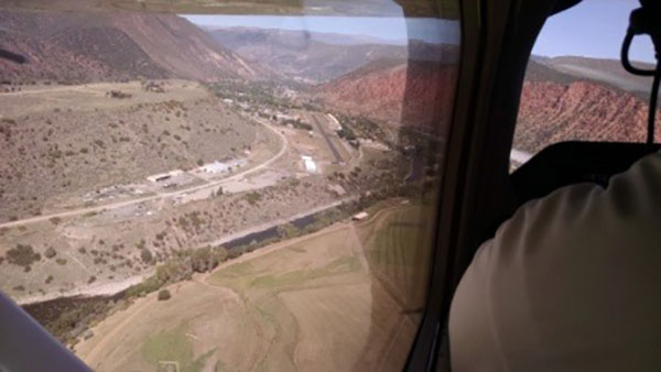
On our ascent we chose to do some scenic flying towards some interesting rock formations. Up and over valleys and peaks, we picked our way northwest toward Glenwood Springs and to the Glenwood Springs Municipal Airport (GWS) which was situated at the bottom of a valley next to the Roaring Fork River.
This was an attention-grabbing airport and my mind was racing on ways to complete the best pattern since the left base leg for the 3,305-foot runway 32 was above a plateau and the runway was below the plateau. The suggested pattern altitude was about 1,200AGL. I turned base to final and noticed I did a poor job of energy management because we were really high. I put in full flaps and slipped the aircraft trying to save the approach. Seconds later I aborted the high approach and completed a go-around and set up for my next attempt.
Glenwood Springs Airport (GWS)
I was able to get the aircraft on a better path on the final. Getting closer to the end of the runway I was focused on the runway length and the numbers while coming in a little slow and low. Right before the runway is a drop off to the river. Our instructor Ed could see we were coming in low asked me to put in some additional power because he knew that drastic elevation changes and drop offs before the threshold can produce erratic downdrafts or updrafts. This was a great lesson for me to learn. I put in some power trying to arrest the descent, then not feeling the immediate level off and realizing I was on the back side of the power curve I added more power, felt the air draft changes over the river, felt my heart stop for a minute and bounced my way down the runway to land. We taxied to the opposite end of the runway, pulled off to the edge for a run up as I gained my composure and we departed runway 14, this time without throttle limitations and the full use of the turbocharger. It felt as if we were screaming down the runway and lifted off really early compared to our previous self-limiting manifold pressure restriction take offs. The turbocharged Skylane piston makes mountain flying much more comfortable than a normally aspirated Skylane aircraft due to the high-density altitude.
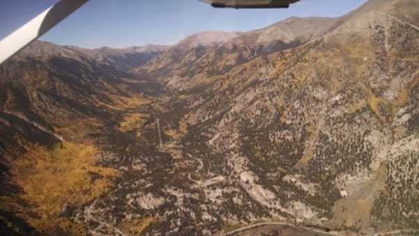
Scenic views while returning to Leadville
We made our way back towards Leadville for my last high elevation landing. We followed the Frying Pan River to Ruedi Reservoir. We were roughly eye level at 12,000 feet with the Red Table Mountain RCO (Remote Communications Outlet) and Red Table VOR (VHF Omnidirectional Range) and we picked our way through Hagerman Pass.
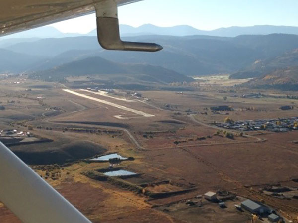
Back into the Leadville valley we listened to the ASOS and determined a landing on 34 would be appropriate with the northerly winds. On the downwind we slowed down to let a back taxiing aircraft set up for their departure. Getting ready for the landing I had the Glennwood Springs landing fresh in my mind, I came in a little fast and floated in ground effect for a while. We back taxied for takeoff on runway 34 and used the full capability of the aircraft because of the increased temperature and density altitude. We climbed out of the valley with ease and we were on our way for our final Colorado stop, Pueblo (PUB). Unfortunately, it was literally all downhill from there.
View of Pikes Peak
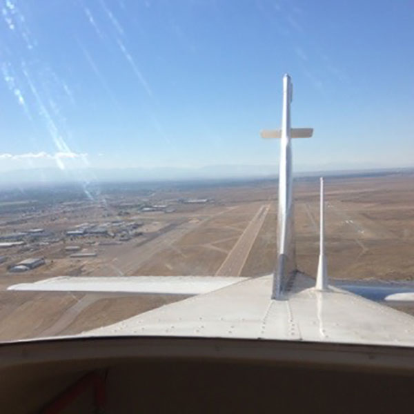
Departing Pueblo Airport (PUB)
John planned our final leg to Beech (KBEC) at 15,000 feet and we were on our way back home. The supplemental oxygen helped clear my minor altitude headache and the view at FL150 (Flight Level) was spectacular, less the mountains.
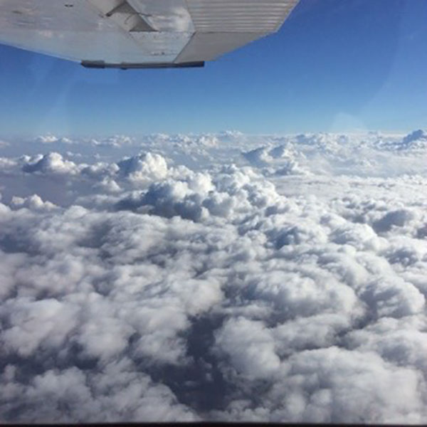
15,000 feet somewhere over western Kansas
During our flying, I gained a great deal of mountain respect and the do’s and don’ts of mountain flying by instruction and by my own mistakes. It was a great experience to sit in the back of the airplane and immerse myself into the beauty of the mountainous terrain and changing fall colors while John flew his legs. Flying with Ed and John was great because we all had safety in mind and we all felt comfortable to ask any questions that came up. The Cessna Skylane piston is a marvelous aircraft with the speed and agility needed to fly in the mountains.
2021 update: It has been five and a half years since this flying instructional course. Since that time my wife and I have taken multiple trips over and through the mountains in the Cessna Skylane piston. We have traveled to Logan Utah, Boise Idaho, and a scenic flyby of Yellowstone National Park. The best way to see a national park! The freedom of picking a location, flying to that destination when you want and staying for as long as you want is incredible.
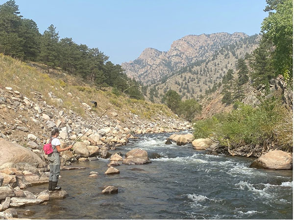
Using the Skylane piston during the COVID-19 pandemic afforded us a safe and private vacation from Wichita, Kan. to Fort Collins, Col. We were able to easily abide by the COVID restrictions by flying ourselves. We fly fished the Cache la Poudre and the Big Thompson rivers. One day we decided to take the Skylane aircraft and fly through the same area five years prior, Berthoud pass on our way to Granby, Colorado. Two and a half hour drive was shrunk into forty minutes. Shortly after landing we were in a courtesy car on our way to fish the tail waters of Grand Lake.
Time savings, personal protection and pure freedom of the Cessna Skylane piston have given me and my wife some amazing trips and memories that will last forever.
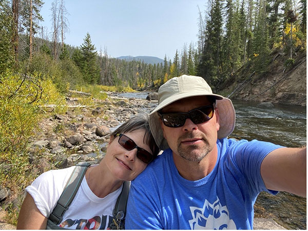
Dan & Cathy Holmes 2020 Granby Colorado
Pouder River, Colorado
Videos and stories contained in this site may contain information that while accurate at the time of publication, has since been updated. Please connect with a representative for any questions.